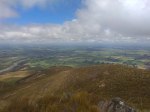
While in Christchurch doing a block course for my engineering diploma, I decided to catch a summit. Mount Alford had not been activated yet so I decided it was a good one to put in the log. During the drive out I drove through several shower bands and was struggling to convince myself this was still a good idea. I rechecked the metservice forecast and it did not show any signs of rain so I persevered. From the car park to the summit is a tough walk – for me at least. The track was in good condition and the shelter in the lower part of the track was appreciated. Most of the way up the summit was capped in cloud which I thought would be disappointing, however as I summited the cloud lifted up enough to give me great views of the plains in front and the mountains behind.
From the summit I had my lunch, and got on the air. A quick squawk on the handheld got me my first contact from Geoff ZL3QR. I deployed the dipole onto 40 and worked John ZL1BYZ although he said my copy was weak. More VHF while CQing on 40 then 20 then 17. No more contacts on HF other than I heard Jackie 59+ and the radio shut down from low battery! O the pain! Another contact on VHF brought me to a total of 8 contacts from this summit, but only 1 on HF. Chucked everything back in the pack and headed back down.
This was a good walk but it isn’t a quick summit. My legs were feeling it for the following few days, and I may have got a little sun burnt as well despite the cloud cover. All an all a nice 4 points added to the log bringing my activator score to 199 and my uniques count to 75.
Details
Summit – ZL3/CB-568 – Mount Alford
Height –1171 m (height gain of 610m)
Access – Carpark is at the end of Alford Forest Settlement Road. From there the track goes across farmland, through gates and up the mountain. The track is clearly marked.
Nominal time to summit – About 1.5 hours drive from Christchurch. 3.5 hour walk to summit.
Mobile and internet coverage from the summit – Limited coverage – if you stand in the right place you can get spots out.
Repeater coverage – 705 is easily accessible from the summit.
Summit Marker – Cairn + marker pole.
Land Access Permission – Not required – DoC Land, however access is forbidden between 20 September and 20 October.


