10 points awaited Warren, with a 3.30am wakeup – planning a sunrise hike with kids in tow didn’t quite work as planned. Warren’s cousin Olivia was to join us for the hike today but we never did cross paths in the end, she was up and down well ahead of us, although we are pretty sure we saw her going up on another track.
We missed the sun rising though did see it start to come up on the road to the carpark at the bottom of the track. We arrived at approximately 5.45am

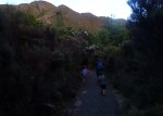
The start of the track is shaded by bush, although that does not last long and from there all the way to the top you walk exposed and in whatever conditions mother nature has in store. Today for us that was pretty windy – more so than we were expecting. At one point Wyatt (6yrs) was prepared to sit and wait a good 2 hours for Warren and Myah to go to the summit and come back to where we were, I on the other hand was not so keen to sit it out with him in that one spot. The wind was cold and strong and there were times where we were left to sit and wait out the gusts on the slopes. Other times we hung onto rocks or sat on the ground and waited it out before carrying on.


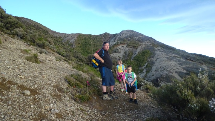
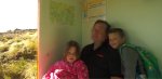
Probably the most challenging part of the hike was a rather steep slope of scree, that took a good 15-20mins to climb up….and slide back down on the way back down from the summit. This was certainly a point in the hike where we had to stop and prepare ourselves as it was a hands and feet climb to the top of the slope and for a good part of the decent it was sliding on backsides. Or slipping and landing on backsides as it was for some. The photo below is Warren, Myah (8yrs) and Wyatt (6yrs) preparing for the scree slope climb (the start can be seen in the left of the photo)
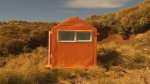
After the scree slope, came the rock climbs through the mountain ridges and slopes before coming out in a clearing with a steep climb up an exposed hill side, probably the hardest part of the hike aside from the scree climb. The next stop was at the Dominie Bivy, which included a long drop loo with a view! We all stopped here for about 20minutes before heading off again for the last part of the climb to the summit. Once the kids and i walked up the path and to where you had to go around the side of the mountain the wind was coming in at a mighty speed and we made the decision to head back as safety for the kids was priority While i was disappointed not to have made it to the summit myself Warren tells me we made the right decision and he had come close to turning back himself.

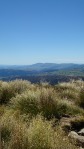


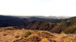
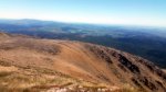
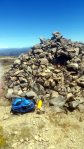
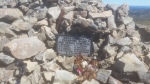
Once at the top, the set up was simple. The dipole was slung between the memorial cairn and a warritah at the trig point. Sheltering on the lee side of the cairn I managed a few contacts on 14 MHz, one on 7 MHz (the aerial wasn’t loading up for some reason) and then worked a handful of locals on 146 MHz FM simplex. I got some food into me, some photos, and then packed up and power walked back to the hut where Emma and the kids were waiting. We descended the balance of the hill and made it back to the bottom, slightly pinker and very tired. This summit is a nice place on a nice day – but you have to pick your day carefully. It is very exposed and the track is steep in places. Always take plenty of water as the walk up is strenuous. A hand held radio on 725 repeater is good for safety comms. The track gets close to some sharp drops in places. The rewards at the top are well worth it on a clear day.


Summit Information
ZL1/HB-001 (Kaweka)
Summit height – 1724 m
Access via Puketitiri, Whittle Rd, Kaweka Rd, Makahu Car Park, Makahu spur track to summit.
Nominal time to summit – 2.5 hour walk to summit.
Summit marker – Trig Station has blown away but its footings remain with a metal tube + warritah to mark the summit.
Land access permission – Not required – national park..

![]()