So recently we made a trip to Norfolk. Yeah we have heard it all before, why Norfolk? …..You know that is where the oldies go right? Well that suited us just fine, the slower pace the quieter life and while that certainly was reflected on the Island there is more to do than you think, yes, including a lone summit for activation. It is virtually a drive to, with a 500meter easy walk to boot, though in the heat it made the stroll seem a bit longer as you can well imagine. Yes we were on honeymoon and yes SOTA did feature….more than once, but more about that activation in another blog post.


Mount Bates can be accessed from a few points, but we took the drive almost to the top option since we really were on holiday and here to relax not slog it out in the heat and walk for miles up hills. Basically you can drive around the entire Island in a day so it really isn’t a big deal and there is no specialist vehicle’s or fitness levels required to activate Mount Bates.
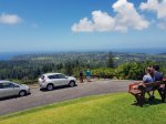


Entry to the walk way to Mount Bates is from Mount Pitt car-park (there are others, however this is the one we chose) Its a well maintained track, not like any we have come across here in NZ, almost like someone has been in there with a ride on mower in fact. From there it is a short 500meter walk across to Mount Bates Summit, with a few stop points for looking out at the view.


While there is not a huge amount of “view” from Mount bates due to bush land there is a few spots to peek out and see some of the Island from the top, with Excavations at the top are relics of a WWII radar station.


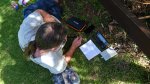
Shade was limited at the top but we managed to find a spot along a fence and sit ourselves down for the next few hours to catch some contacts. We started out on 14 MHz and quickly made the first 4 contacts. With no cell data we text Kyle ZL2KGF to spot for us on sotawatch. After that the contacts kept coming, including a summit to summit with VK2JDL on VK2/IL-007. The callsign was a bit of a pain but after 18 contacts we gave 21 MHz a go and gathered another 3 contacts. I thought I would give 28 MHz a go and made 2 contacts but it was fairly poor so back to 21 MHz for another 8 contacts at which the radio shut down. I’m not sure whether it was battery or heat but that had been 2 hours and the contacts had all but dried up so time to pack up. 31 contacts in total including FK8IK from New Caledonia. Contacts have been uploaded to LoTW as official VK9N as well.


While I played radio Emma had a nap under a tree and sometimes I thought that was a far better idea and often called while lying on my back staring at the clouds and a pair of birds circling high above. But then someone would respond to my call and I would have to get up and start filling in the log. This is definitely a summit to put on the must do list, as you get an island holiday to go with. This one ois gri’.
Details
Summit – VK9/NO-001 Mount Bates
Height –319 m (net ascent from Mt Pitt = 1 m)
Access – From summit of Mt Pitt, Mount Pitt Road
Nominal time to summit – About a 20 – 30 minute walk
Mobile and internet coverage from the summit – Voice and text only – no data.
Repeater coverage – nil.
Summit Marker – Information boards and lookout site.
Land Access Permission – National park, not required.