Tuhua is very near one of my work’s radio sites. A fault at this site had me make plans to spend a few days at the site, repairing the fault and installing new equipment. There is no vehicle access to this radio site so access is done by helicopter. I was delivered to site Thursday afternoon and planned to be picked up again Saturday morning. By 5pm Friday I had finished all I could do so thought I would try to access the true summit for SOTA. Kudos to my family at home for understanding this unexpected few days away 
-

Radio Hut at Trig -
-
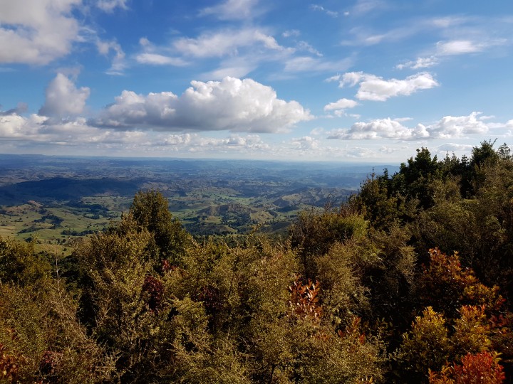
View South West -

View South East to Ruapehu

-
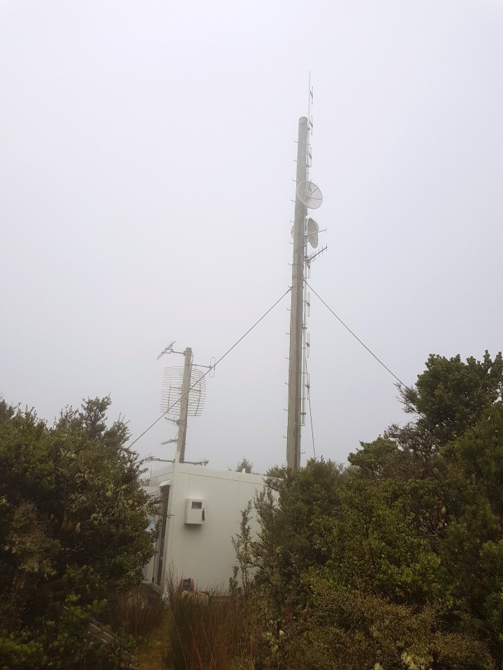
My Radio Site -
-

Valley to get across between my radio site and the trig

To get to the summit – it is about a 300 m walk / bush bash East across a small valley. The bush is quite dense particularly near the radio hut I was working at. GPS and map skills are required as it would be very easy to get lost. At the summit there is a radio hutt with a solar panel. The solar charger caused me some interference on 40 m but I still managed to make 7 contacts – all on 14 MHz.
Before I left for my bush bash – I left a radio inside our radio hut on a telemetry channel with the volume turned up. This was so that if I missed my hut and walked past it in the bush I could listen for the telemetry sounds and guide myself back. Our radio hut was just a small spot on the hill and I didnt want to get lost.
Older topo maps show a track to Tuhua trig. The latest maps do not show this track however there are signs of it – despite it not being maintained for many years. The top end was clear enough – however you would need to be short! The bottom end of the track I hunted for when I activated Motere (ZL1/MW-077). I think it has overgrown with Blackberry but with some gardening tools it is probably accessible. The land at Tuhua is DoC land, however there is farmland nearby and the landowner doesnt take kindly to trespassing without his permission. He has had trouble with trespassing historically so this is a fair stance given the remoteness. Stay on the DoC land or get permission if you want to attempt Tuhua from the farm (this would be doable I would imagine with a short bushbash to the trig). A helicopter flight is always an option too 
Details
Summit – Tuhua ZL1/MW-071
Height – 1042 mASL
Access – In this case – Helicopter (see text)
Coverage – Mobile coverage OK on Telecom. Repeater coverage good into 715.
Summit Marker – Trig gone – Clearing and radio mast.
Land Access Permission – DoC Land – permission not required (see text).
NB: Photos are not for use elsewhere, without prior approval.